Boreal Logging Scars: an extensive and persistent logging footprint in typical clearcuts of Northwestern Ontario, Canada is also a photo report. The research studied real forest operations, at the clear cut scale. To convey that detail, the report contains many images. Several have been included below for high res downloading, just right click to save the image. All photos by T. Hesselink unless otherwise indicated.
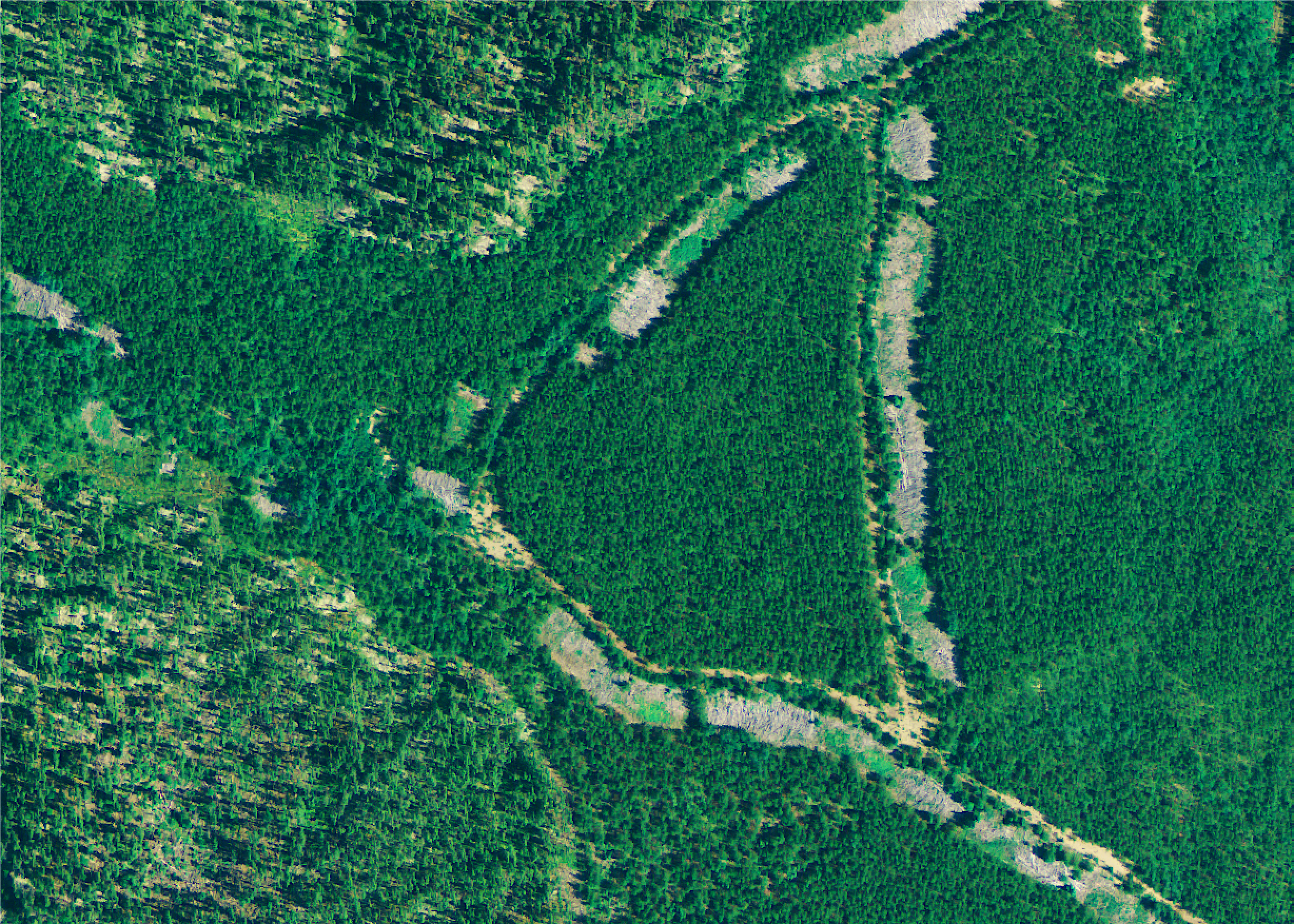
Site 701, 16 yrs after logging. Aerial photo from OMNRF. Logging scars from roadbeds and landings. They are formed by heavy machinery to haul trees to side of road. In decades after clearcut logging these areas remain barren. They are deforested.
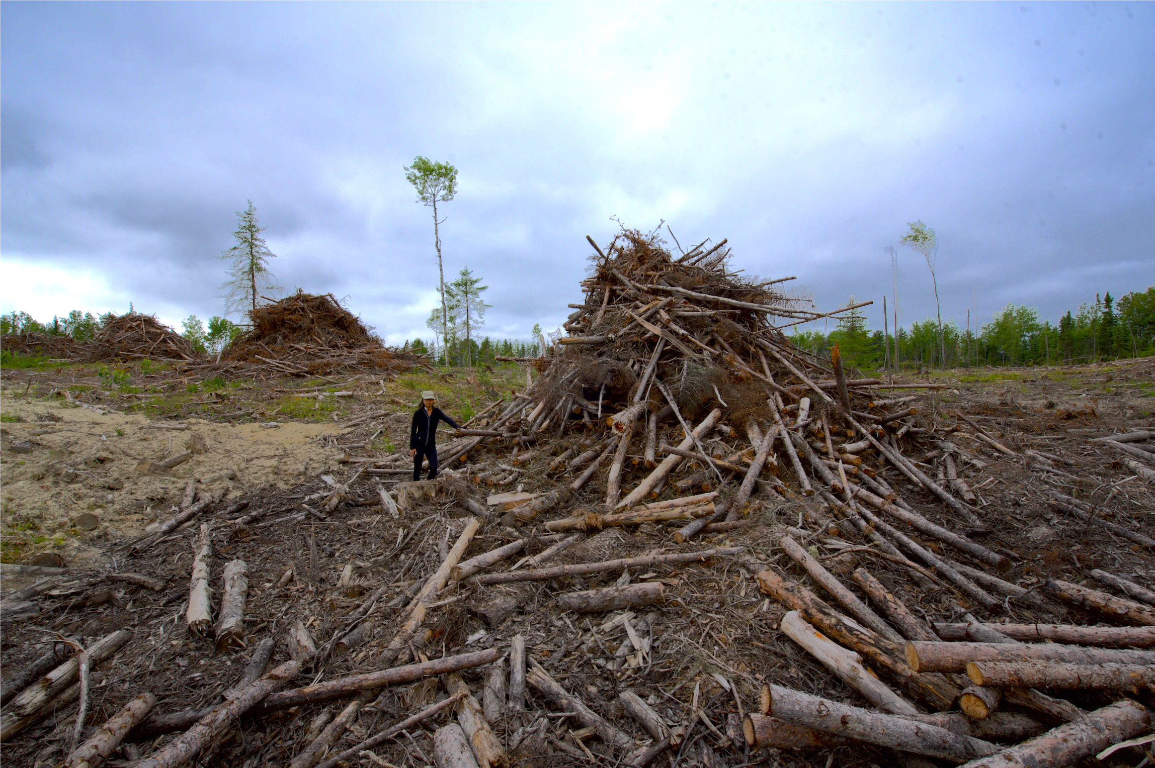
The logging practice of dragging trees to roadside and leaving waste piles contributes to a growing legacy of logging scarred areas. Research assistant Victoria Yeh is standing by pile.
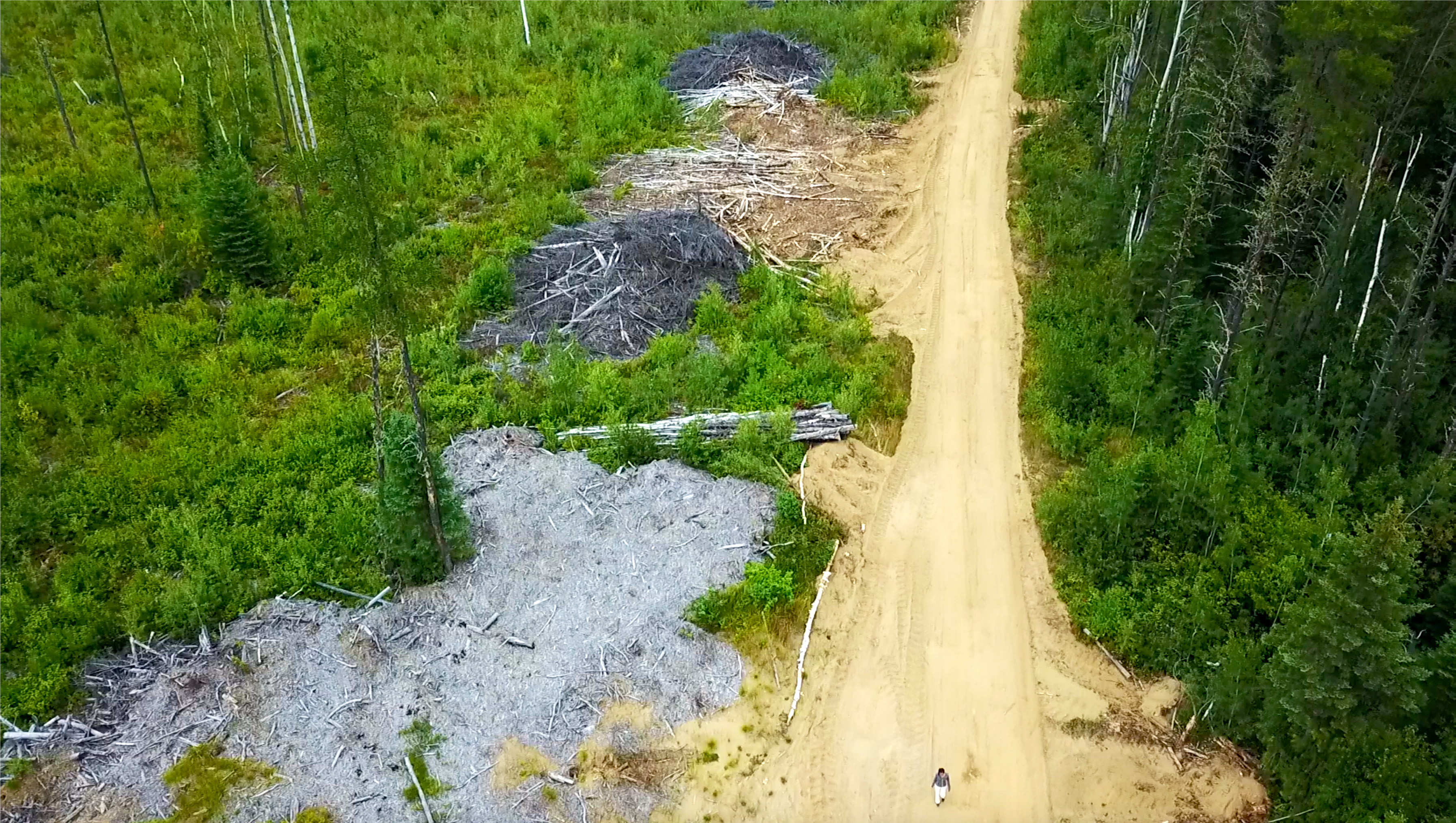
Drone photo, 2018. A recent seven-year old clearcut showing, piled slash, processing areas, and a blanket of chipping debris. Note human scale.
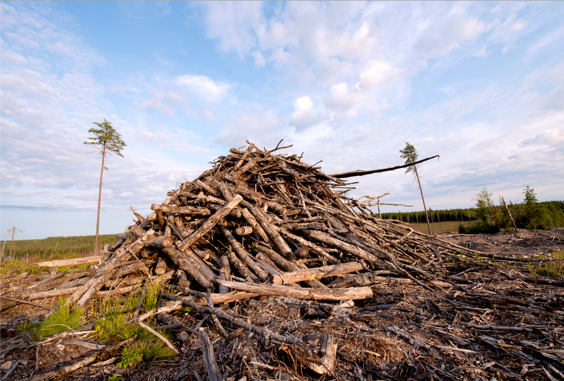
2018 photo. Slash piled at recent cut along Moose Lake Rd near Normandy Block in NW Ontario.
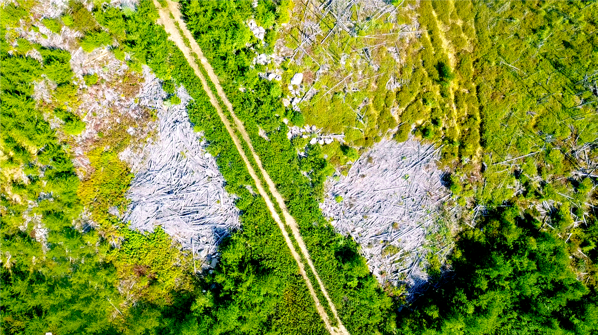
Drone photo, 2018. Site 130. Lac Seul forest clearcut, logged in 2008 and subjected to roadside slash-burnign. Note contrast between landings (aren’t renewing) and surrounding clearcut (is renewing).
Canada’s logging scars are under-the-radar of national deforestation monitoring.
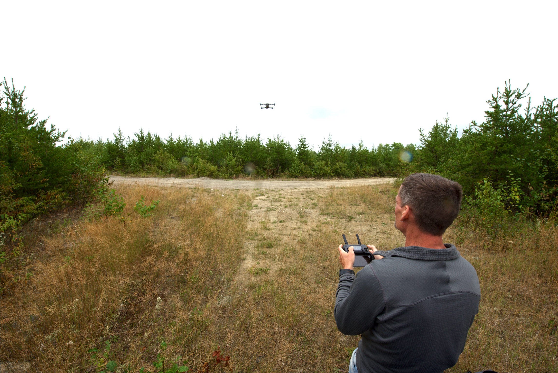
The author deploying the drone in 2017 site visit. Photo by Victoria Yeh.
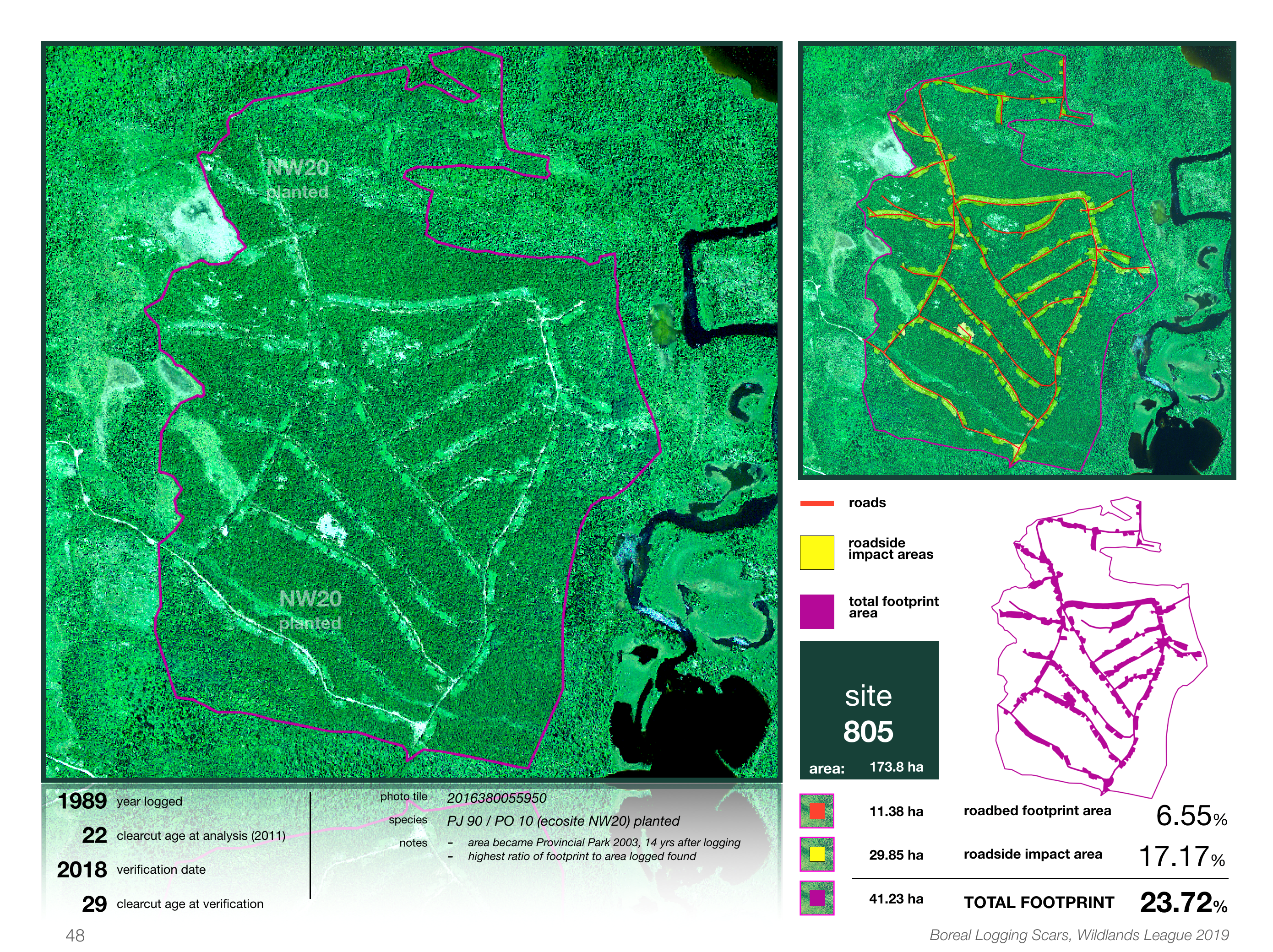
The data on site 805 from the study. Data for all for all 27 clearcuts over the study area in NW, Ontario, Canada can be found in Part Two of the report.
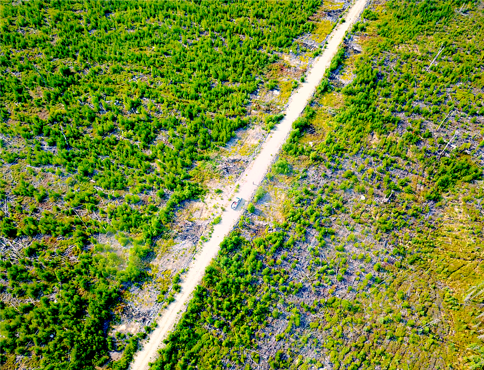
Drone photo 2017, Abandoned branch road near Armstrong. Note wide and slash choked landings, track bare roadbed, and relative productivity of centreline and ditch line for shrub succession.
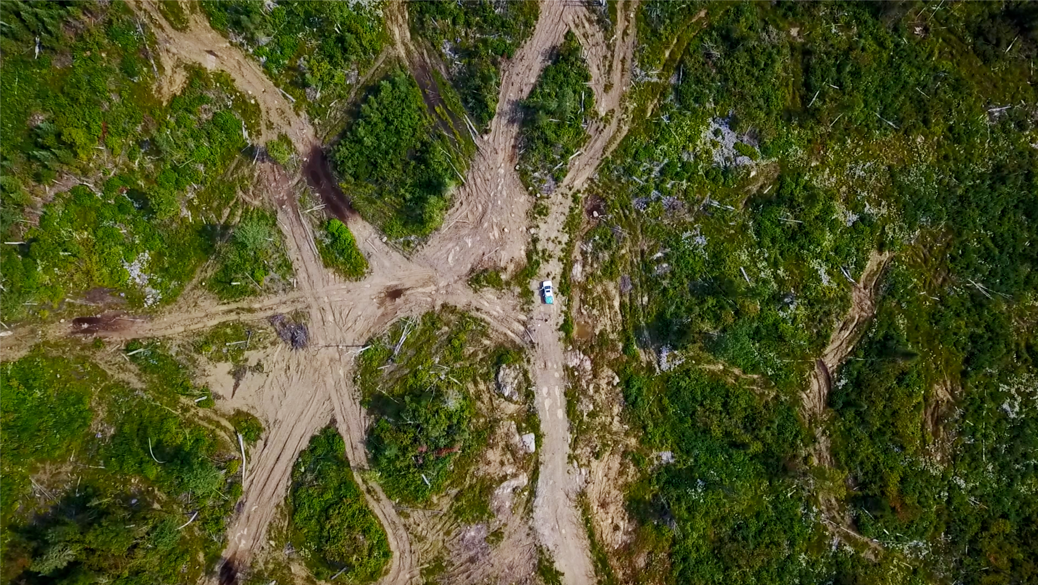
Drone photo of roads crisscrossing. Note impacts of heavy machinery on land.